You are here :
Home Time Series Maps | South Karanpura Coalfields
|
Last Updated:: 21/09/2015
Time Series Maps | South Karanpura Coalfields
TIME SERIES MAP
Landuse . Landcover . Map
South Karanpura Coalfields
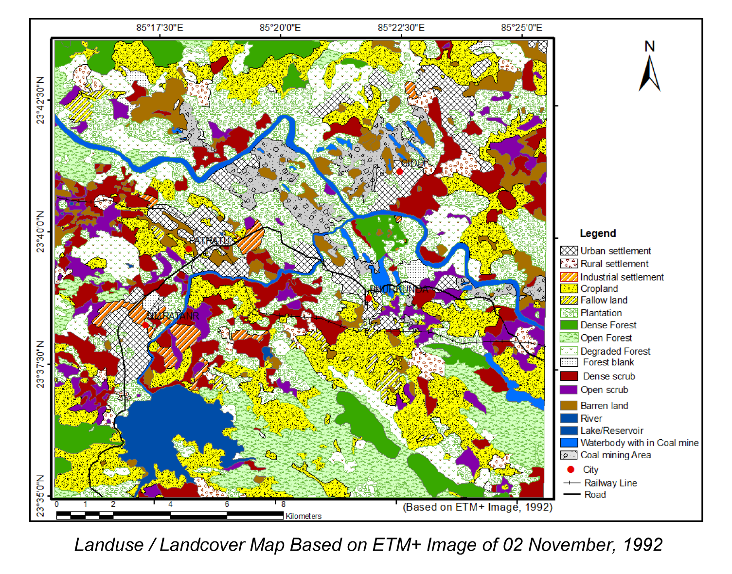
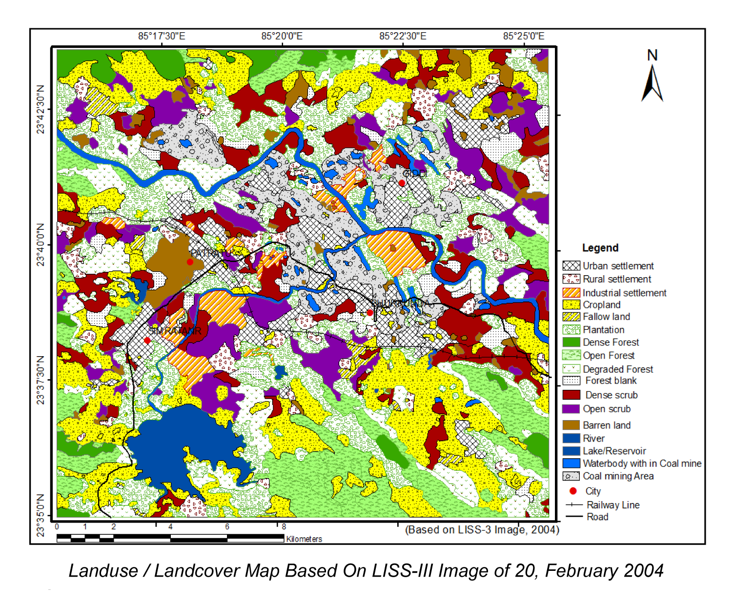
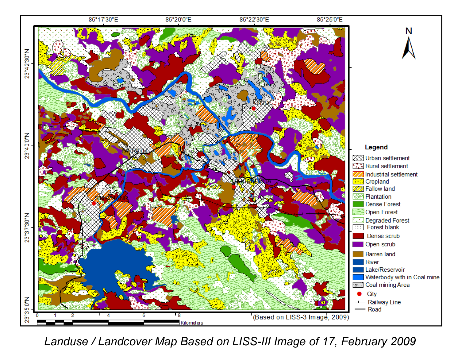
(Source: Kumar, A. and Pandey, A.C. 2013. Evaluating Impact of Coal Mining Activity on Landuse/Landcover Using Temporal Satellite Images in South Karanpura Coalfields and Environs, Jharkhand State, India. International Journal of Advanced Remote Sensing and GIS, 2(1):183-197)