You are here :
Home GIS-based assessment of recent changes in drainage and morphometry of Betwa River basin and sub-basins, Central India
|
Last Updated:: 10/02/2022
GIS-based assessment of recent changes in drainage and morphometry of Betwa River basin and sub-basins, Central India
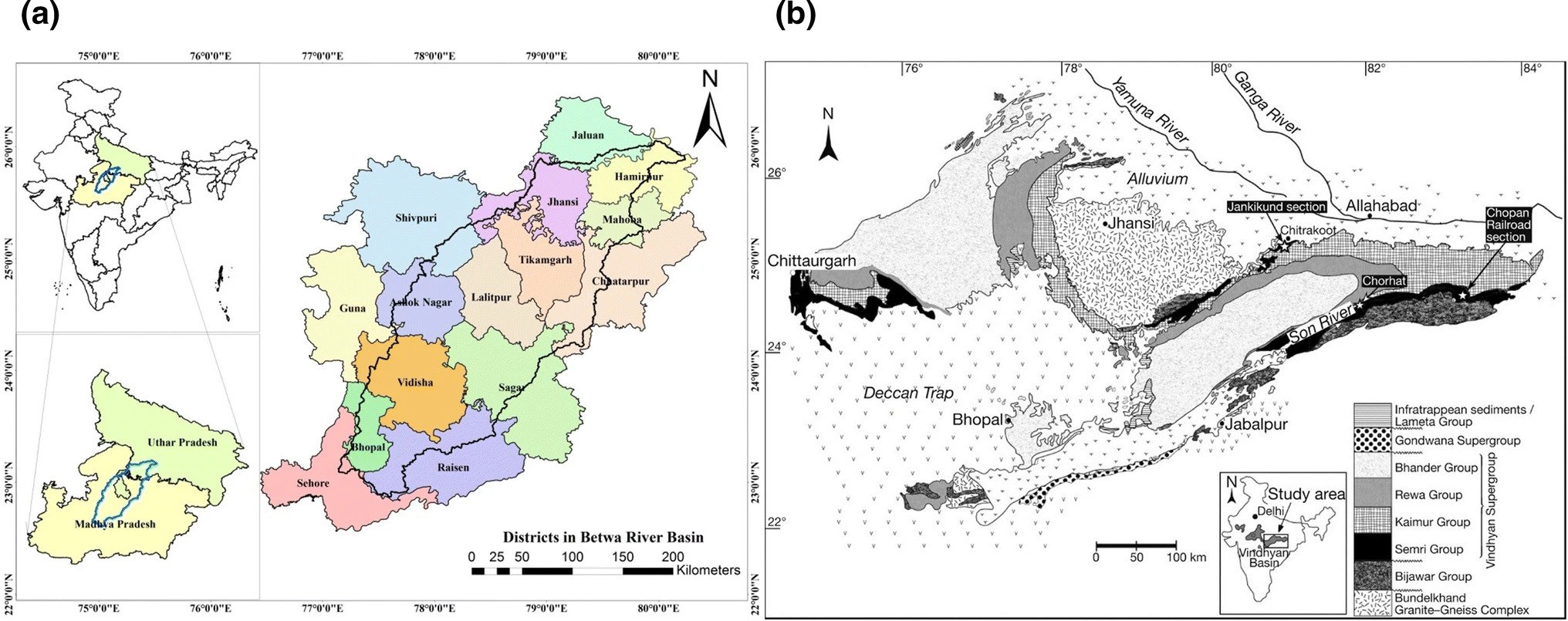
Betwa River basin: (a) location map and (b) geology of the study area
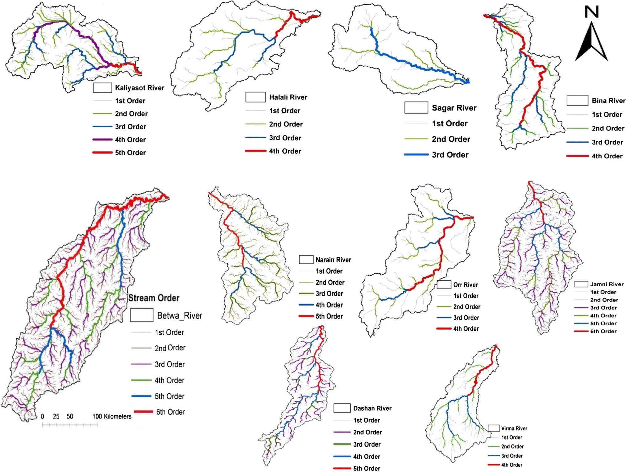
Drainage and stream order map of the Betwa River basin and sub-basins
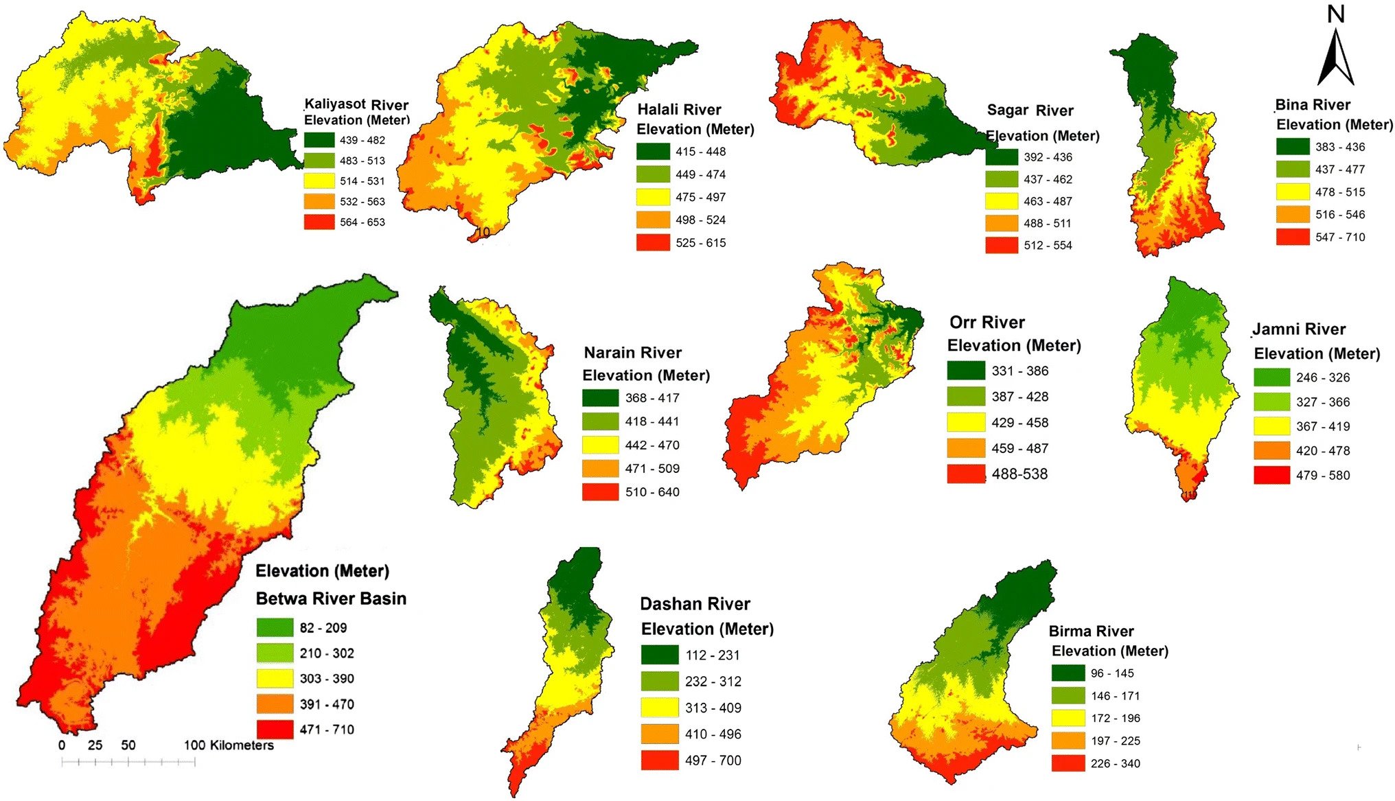
Elevation map of the Betwa River basin and sub-basins
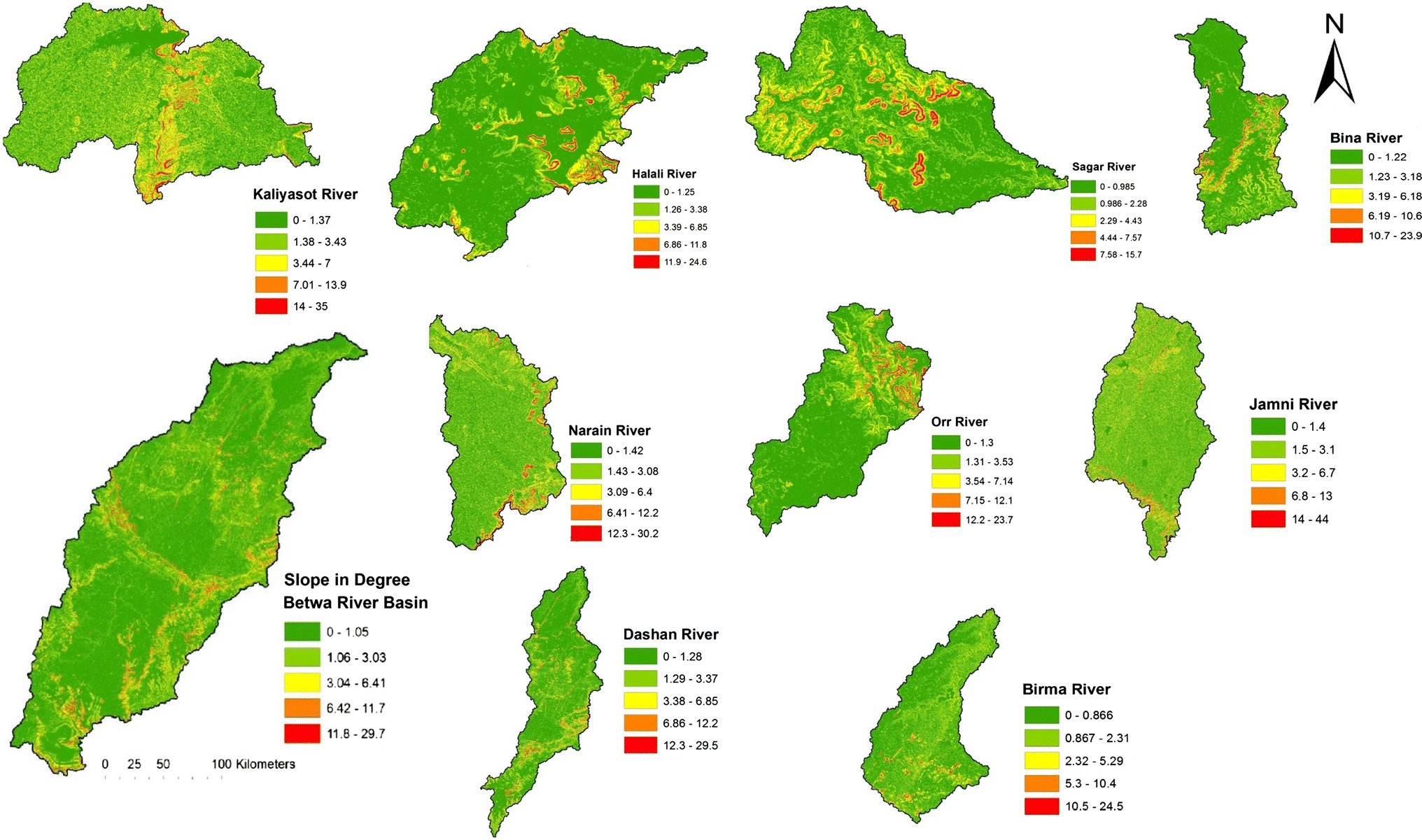
Slope map of the Betwa River basin and sub-basins
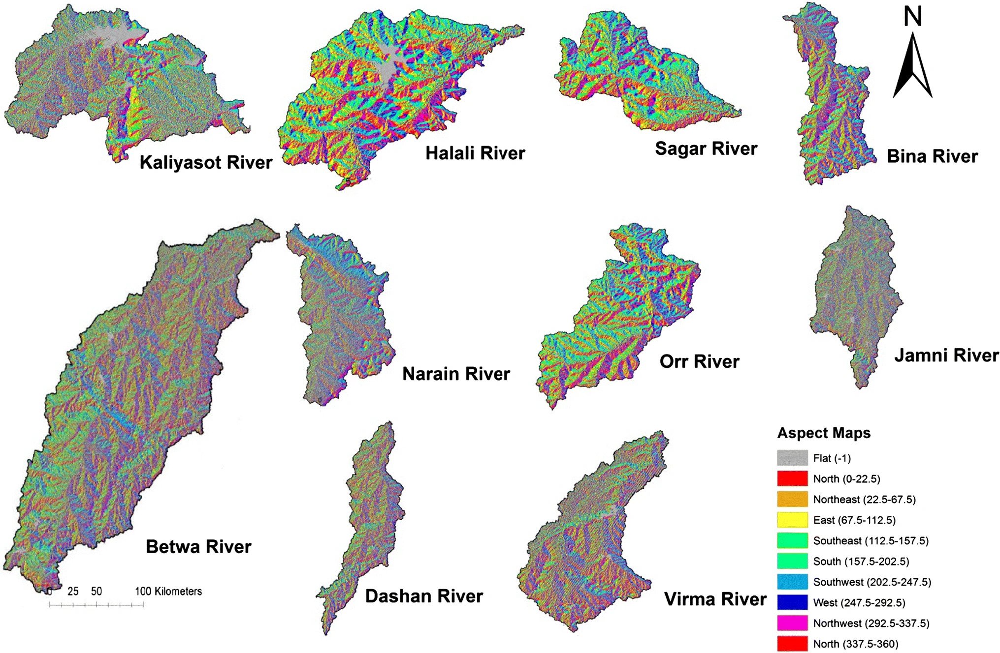
Aspect map of the Betwa River basin and sub-basins
(Source: Venkatesh, M., Anshumali A GIS-based assessment of recent changes in drainage and morphometry of Betwa River basin and sub-basins, Central India. Appl Water Sci 9, 157 (2019). https://doi.org/10.1007/s13201-019-1033-6)